
This is the type of terrain my father and I will be up against in west Georgia this year. The property to the north of us was just clear cut, so you now can see exactly how drastic the changes are in elevation. Some of these bottoms have drop offs up to at least 200 feet according to the topography maps. In my opinion, utilizing maps such as topography maps and google maps is key especially when you have just acquired a piece of property you plan on hunting. Don’t be afraid to use technology to your advantage, after all how many more animals do you think the legend Fred Bear would have harvested if he were using one of the compound bows in today’s market?
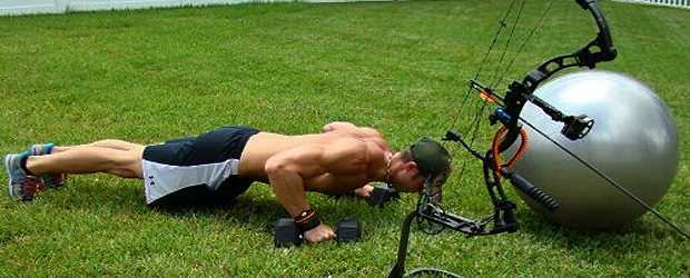
By using topography maps, it will be easier to find the deep parts of the bottoms. And guess where all the big deer will be come early bow season, in those nice, cool thick bottoms. The never ending job of scouting has begun. In order to be successful, you must first go to where the big deer are located. That might require traveling through the deep, deep woods, which will require you to be in shape. I am talking about a mile or so back in. You have to be innovative! We are making a hoist and a pulley system to repel down into these bottoms quietly. I heard a fact, which I believe is very true, that most hunters do not travel further than a quarter mile in the woods from where they park their truck, bike or four-wheeler. I am not saying you can’t harvest a mature deer that way, but if everyone is traveling the same distance into the woods, then the odds stack against you on that deer traveling in your direction and it being harvested by someone else. The deeper you travel, the less pressure there is on the deer and the greater the chance you will have to see more mature deer.
Our first job on this property is to find their food sources such as the white oaks, red oaks, water oaks, honey suckle, persimmons, and so on. We will be forced to walk and climb in search of these essentials. We will have to be very observant of the acorns dropping or the honey suckle and persimmons blooming and set trail cameras to see what type of game is in the area. It is very important to take a mental note or GPS coordinates of trails and funnel systems. Just recently, I found a device on my phone that gives me an exact coordinate of where each picture was taken. This will help out a ton when following a scrape and rub line in order to find the best stand location. I learn and experience something new on every hunt, which enables me to be a better and more successful hunter so I can teach others. I can’t wait for the challenge! Stay tuned to see how our season is going to unravel with memories.


